

Visitors planning hikes, bike rides and other outdoor activities in the Santa Monica Mountains will face a new set of access rules beginning October 15, as four public agencies introduce a coordinated closure protocol for periods of extreme wildfire weather.
California State Parks, the National Park Service, Santa Monica Mountains Conservancy and Mountains Recreation and Conservation Authority announced the new approach on October 14, 2026. The policy is intended to create a consistent response when the National Weather Service issues a Red Flag Warning for the region.
The first coordinated closures are scheduled as the National Weather Service forecasts a Red Flag Warning beginning Thursday, October 15, and continuing through Friday night, with the possibility of an extension into Saturday. The warning covers portions of the mountains of Los Angeles and Ventura counties, where forecasters expect strong northeast-to-east winds, very low humidity and conditions favorable for rapid fire growth.
For California travelers and Los Angeles-area residents, the change is significant because the Santa Monica Mountains contain a large network of interconnected public lands managed by different agencies. Under the new protocol, visitors will receive more consistent closure information instead of having to interpret separate policies at individual parks.
Why The Agencies Are Coordinating Park Closures
The Santa Monica Mountains function as one continuous landscape even though different sections are administered by state, federal and local agencies. A wildfire does not stop at an administrative boundary, which makes coordination especially important during periods of extreme fire weather.
The new protocol brings together California State Parks, the National Park Service, Santa Monica Mountains Conservancy and Mountains Recreation and Conservation Authority. The agencies already cooperate through a broader management agreement covering the Santa Monica Mountains, but the new framework establishes a more specific process for Red Flag Warning closures.
Jody Lyle, superintendent of Santa Monica Mountains National Recreation Area, said the coordinated approach is intended to reduce confusion because the mountains constitute a single landscape despite being managed by several agencies. Joseph T. Edmiston, executive director of the Santa Monica Mountains Conservancy and executive officer of the Mountains Recreation and Conservation Authority, also described the framework as a way to provide clearer direction when wildfire conditions become unusually dangerous.
The policy is aimed at two related problems.
First, closing recreation areas can reduce the possibility of an accidental ignition during periods when vegetation is extremely dry and winds are capable of spreading fire quickly. Second, keeping visitors out reduces the number of people who could become trapped or require evacuation if a wildfire starts.
That second concern is particularly relevant in the Santa Monica Mountains, where narrow roads, steep terrain and scattered residential communities can complicate emergency evacuations.
Six State Parks Are Included In The First Closure
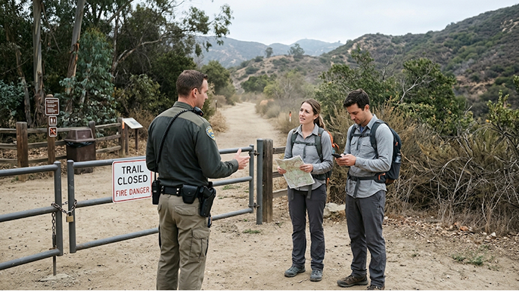
For the initial Red Flag Warning period, California State Parks identified six properties that will be subject to the coordinated response:
- Leo Carrillo State Park
- Malibu Creek State Park
- Point Mugu State Park
- Topanga State Park
- Will Rogers State Historic Park
- Santa Susana Pass State Historic Park
The National Park Service, Santa Monica Mountains Conservancy and Mountains Recreation and Conservation Authority manage additional sites that can also be affected when the geographic extent of a Red Flag Warning warrants closure. The potential closure network includes places such as Solstice Canyon, Rancho Sierra Vista, Rocky Oaks, Paramount Ranch, King Gillette Ranch, Backbone Trail, Sandstone Peak, Temescal Canyon and several other open-space areas.
The exact list of closed locations can change from one weather event to another. Agency superintendents and directors will determine closures based on where the National Weather Service forecast indicates dangerous conditions.
That means a Red Flag Warning should not automatically be interpreted as a blanket closure of every public property throughout the entire Santa Monica Mountains region. Visitors need to check the current status of the particular destination they plan to visit.
Hiking And Mountain Recreation Will Be Restricted
The closure protocol specifically targets activities that place people in exposed mountain environments during extreme fire weather.
During affected closures, visitors should expect restrictions on hiking, mountain biking, horseback riding and picnicking in closed areas. Trails and undeveloped backcountry areas may be closed, along with selected parking areas, visitor centers, programs, school field trips, volunteer activities and permitted events.
California State Parks has already posted the Red Flag closure language on individual park pages. At Leo Carrillo State Park, for example, the agency states that riding and hiking trails, fire roads and undeveloped portions of the park are closed during a Red Flag Warning.
Malibu Creek State Park has similar restrictions listed, although the park is also dealing with a separate water-main problem that has temporarily affected drinking water and restroom facilities.
This means travelers should avoid assuming that a park page showing the property as generally open means every recreation area is available during a Red Flag event.
Some Roads And Facilities May Remain Open
The new policy does not mean every road, developed facility or coastal location automatically becomes inaccessible.
Depending on the agency and specific conditions, public roads may remain open unless they are behind a locked gate. Certain developed parking lots and roadside overlooks can also remain accessible. Campgrounds may remain open under standard evacuation and emergency communication procedures.
Beach areas are generally treated differently from mountain backcountry areas under the protocol, although specific hazards can trigger separate restrictions.
This distinction matters for travelers because a visitor may still be able to drive through portions of the Santa Monica Mountains or reach certain coastal locations while hiking trails and undeveloped areas are closed.
The safest approach is to check the current destination status rather than interpreting the word “closed” as applying identically to every facility.
What A Red Flag Warning Means For Visitors
The new protocol relies on official forecasts from the National Weather Service Los Angeles/Oxnard office.
Red Flag Warnings are issued when a combination of weather and fuel conditions creates an elevated risk of rapid wildfire growth. The protocol specifically considers factors including relative humidity, sustained winds, wind gusts and dry lightning, together with low fuel moisture.
For the current event, the National Weather Service forecast calls for northeast-to-east winds of approximately 20 to 40 mph, with gusts reaching 50 to 70 mph in the affected mountain zones. Minimum relative humidity is expected to fall into the 8% to 20% range. The warning is currently scheduled from 6 a.m. Thursday, October 15, through 10 p.m. Friday, October 16, although conditions and warnings can change.
Those conditions can turn a small ignition into a fast-moving wildfire.
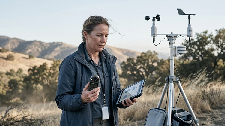
Strong winds can carry embers across roads and vegetation, while extremely dry vegetation provides readily available fuel. Low humidity further limits the amount of moisture available in plants and surface materials.
For visitors, this means a normal autumn hiking day can become substantially more dangerous within a matter of hours.
Closure Decisions Will Be Made Daily
One of the most important features of the new system is that closure decisions will be evaluated daily.
Park superintendents and agency directors will consider the geographic extent and severity of the National Weather Service forecast before determining which properties should close. When possible, agencies will announce the next day’s closure in advance.
If a Red Flag Warning covers only part of a day, the protocol allows affected parklands to remain closed for the entire day. That creates a clearer message for visitors and gives park personnel a simpler operational framework.
This is especially useful for recreation planning. Rather than having a trail open in the morning and close unexpectedly once dangerous conditions arrive, an entire-day closure can give visitors and park employees a more predictable schedule.
However, weather forecasts can change. Visitors should continue checking official updates before leaving home, particularly during Santa Ana wind events.
The Policy Comes During A Higher-Risk Fire Season
The timing of the announcement is significant.
Southern California has entered the part of the year when dry vegetation and offshore wind events can create dangerous wildfire conditions. The Santa Monica Mountains also continue to recover from the devastating 2025 Palisades Fire, which burned through large portions of the region and affected communities, trails and park infrastructure.
California State Parks has continued recovery planning at Topanga State Park and Will Rogers State Historic Park, while some trails and facilities remain subject to restrictions from that earlier disaster.
The new Red Flag protocol therefore operates alongside existing recovery measures rather than replacing them.
For outdoor enthusiasts, this can mean several layers of restrictions at once. A trail may already be closed because of wildfire recovery, while another area may temporarily close because of the weather forecast.
Visitors planning California outdoor trips can use the state’s broader California destinations guide when developing alternatives, but current agency notices should take priority over older travel information.
Malibu Is Also Preparing For Strong Winds And Possible Power Shutoffs
The Red Flag conditions are affecting more than park access.
The City of Malibu issued an alert on October 13 warning of dangerous fire conditions associated with strong winds, low humidity and high temperatures. The city said Southern California Edison could implement Public Safety Power Shutoffs in parts of central and western Malibu because of the forecast conditions.
On October 14, Malibu reported that SCE could shut off power to the Merlin circuit in central Malibu as a precaution because of Red Flag conditions and Santa Ana winds.
Potential power outages add another consideration for visitors traveling through the region. Downed trees and power lines can create hazards on mountain roads, while outages can affect communication and services.
Anyone traveling near Malibu or the Santa Monica Mountains during a Red Flag event should therefore monitor weather and emergency notifications rather than treating the closure as simply a hiking restriction.
What Visitors Should Do Before A Mountain Trip
The new system makes checking conditions before departure particularly important.
Visitors should:
- Check the National Weather Service Los Angeles/Oxnard forecast and current Red Flag Warnings.
- Confirm the status of the specific park or trail with the agency that manages it.
- Avoid entering areas marked closed, even if gates are open or signage is limited.
- Have an alternative destination ready if mountain trails close.
- Expect changing road and utility conditions during strong Santa Ana wind events.
Not every closed area will necessarily have a locked gate or prominent physical barrier. The agencies specifically warn that public notifications can include websites, social media, media advisories and on-site signage, and that some locations may not be signed or gated.
The National Park Service Santa Monica Mountains closure protocol provides additional information about how the system works, while California State Parks provides current conditions for individual properties.
A New Standard For Fire-Weather Recreation
The Santa Monica Mountains’ new Red Flag closure protocol represents a shift from treating wildfire warnings as primarily an emergency-management issue to making them part of everyday recreation planning.
The first coordinated closures beginning October 15 will give visitors a real-world test of the system. Six California State Parks are included in the initial response, while numerous National Park Service and conservancy properties can also be affected depending on the forecast.
For hikers and other outdoor users, the message is clear: when dangerous fire weather arrives, mountain recreation may have to wait.
That temporary inconvenience serves a larger purpose. Keeping people out of vulnerable areas reduces potential ignition sources, gives firefighters and emergency personnel more room to operate and limits the number of visitors who could need evacuation if a wildfire develops.
As California continues to experience increasingly consequential wildfire seasons, the Santa Monica Mountains’ coordinated approach could become a useful model for managing recreation in other high-risk landscapes. The mountains remain an important destination for hiking, wildlife viewing, historic sites and coastal recreation, but access will increasingly depend on the conditions under which those activities take place.
For visitors, checking the forecast and park status before heading into the mountains is becoming as important as checking trail conditions or road closures.