

Big Sur Closures are still shaping trip planning along the Central Coast as of October 22, 2026. The Timber Fire, which began on August 8, 2026, forced park, trail, campground, and Highway 1 access changes across the area, and the later Plaskett Fire kept pressure on southern route planning. If you are considering a coastal drive, a day hike, or an overnight stay, treat every plan as conditional until you check the latest official access notices shortly before leaving.
Big Sur is often planned as a flexible road trip stop, but fire closures make that approach harder. A viewpoint, campground, or trailhead that appears close on a map may sit behind a closure point, or it may be reachable by road while still closed on foot. The safest planning choice is to separate three questions: whether the highway segment is open, whether the park unit is open, and whether the specific trail or facility you want is open. Those answers have not always changed at the same time.
Big Sur Closures By Road And Park Area
The biggest access issue in late summer 2026 came from the Timber Fire. CAL FIRE listed the incident with a start date of August 8, 2026, and the research notes show that Highway 1 was closed between Mile Marker 50.1, one mile south of Old Coast Road, and Mile Marker 42.6, about one-half mile south of Deetjen’s Big Sur Inn, beginning on August 26, 2026 CAL FIRE Timber Fire. That closure changed access for people coming from the Monterey side and made through-routing unreliable.
By September 2–3, 2026, the northern section of the Highway 1 closure supporting Timber Fire work had been lifted from Post Mile 56, just south of the Little Sur River, to Post Mile 45, just south of the Big Sur Post Office. That was a meaningful improvement for local access, but it did not mean the full coast route was clear. The research notes also show that a southern Highway 1 closure tied to the Plaskett Fire remained in effect from Pacific Valley at Post Mile 16 to the Monterey/San Luis Obispo county line at Post Mile 0.0.
How Big Sur Closures Affect Highway 1 Drives
For travelers, the road status matters before the scenery does. A classic north-to-south Highway 1 drive can become a partial out-and-back if the southern section stays blocked, and lodging choices on either side of the closure may no longer connect as expected. If you booked one night north of Big Sur and the next night in San Luis Obispo County, confirm that the drive is physically possible before relying on coastal mileage estimates.
Travelers should also avoid assuming that a reopened highway segment makes nearby hikes available. Fire operations, smoke, unstable slopes, downed trees, and repair work can keep parks or trails closed after traffic begins moving. For a broader report on how the fires affected coastal travel patterns, see our earlier coverage of Big Sur fires and Highway 1 disruption.
Trail And Campground Access After The Fires
The official Big Sur Station and Multi-Agency Facility page continued to flag major fire-related access limits in the area, including state park, trail, campground, and forest access information tied to the Timber Fire and related closures Big Sur Station updates. The research notes also state that the Timber Fire had consumed more than 25,000 acres by early September 2026, with containment around 22% at that point. The Plaskett Fire had burned about 29,000 acres as of early September 2026, which explains why southern access remained disrupted after some northern restrictions eased.
Trail closures were especially broad. Following the Timber Fire, Pine Ridge Trail, Sykes Hot Springs, and most trails in the Monterey Ranger District of Los Padres National Forest were listed as closed in the research notes. Bottcher’s Gap Campground was described as closed indefinitely. These are not minor side routes for hikers; they are among the areas many visitors build entire trips around.
Park Trails Still Need Separate Checks
Pfeiffer Big Sur State Park reopened to the public on October 16, 2026, after the Timber Fire closure, but that reopening did not mean normal trail access had returned. The research notes say about 517 acres of the park burned, including many trail areas. That creates a practical planning problem: a park entrance may be available while individual trails remain closed or limited.
As of October 20, 2026, closure listings in the research notes included multiple trails in Pfeiffer Big Sur State Park, including Gorge Trail, Oak Grove, and Valley View. Julia Pfeiffer Burns State Park listings included McWay Waterfall Overlook and Ewoldsen Loop. Limekiln State Park listings included Falls Trail and Alvin Trail. Because those lists can change after inspections and repair work, visitors should not rely on old screenshots, printed maps, or social media posts.
Camping access also remained uneven. Limekiln State Park’s campground remained closed in the research notes. Some U.S. Forest Service campgrounds, including Kirk Creek, Plaskett Creek, Ponderosa, and Nacimiento, were listed as open, while Bottcher’s Gap was closed indefinitely. Treat Big Sur Closures as a trip-shaping condition, not a small inconvenience, especially if your plan depends on camping rather than a hotel reservation.
How To Plan A Visit With Limited Access
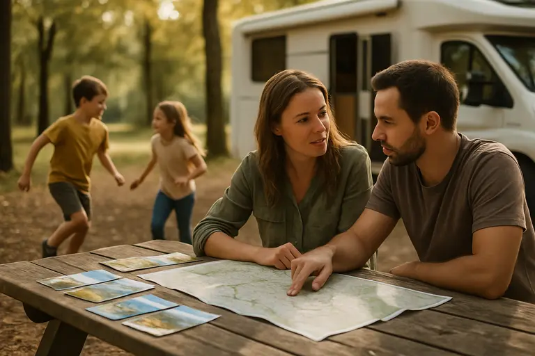
The most useful strategy is to plan from confirmed access points instead of starting with a wish list of hikes. Choose a direction of travel first, then verify whether the Highway 1 segments you need are open. After that, check the specific park unit, then the exact trail, overlook, beach access, or campground. If any one part fails, the plan may need to change.
For travelers who still want a coastal experience, build a shorter plan that does not require passing through a closure zone. That may mean visiting reachable northern areas from Monterey or Carmel, or planning from the south only if the southern closure status allows it. Do not assume you can “just drive around” on small mountain roads; closures, fire response needs, and long detours can make that impractical.
- Confirm Highway 1 status close to departure, especially if your lodging is split between Monterey County and San Luis Obispo County.
- Check the exact park unit, not only the broader Big Sur region.
- Verify trail and campground status separately, because roads and facilities may reopen on different dates.
- Carry a backup plan that does not depend on McWay Waterfall Overlook, Pine Ridge Trail, Sykes Hot Springs, Limekiln trails, or other listed closures.
- Expect smoke, repair work, and fire recovery needs to affect the visitor experience even where access has resumed.
Costs can also shift when access changes. A closed campground may push travelers toward paid lodging farther away. A blocked through-route may add fuel costs or require changing reservations. If your plans are date-sensitive, book options with clear cancellation terms and avoid stacking nonrefundable reservations across both sides of a closure point.
For those exploring California trip planning through various travel and lifestyle resources, The Silver Liners offers insights into slower-paced adventures outside the direct impact of fire zones, being a related site in the same network.
What Big Sur Closures Mean For October Trips
Big Sur Closures do not make every visit impossible, but they do change what counts as a realistic visit on October 22, 2026. The most reliable plans are modest, flexible, and based on confirmed open access rather than a fixed list of famous stops. If your main reason for going is a specific trail, campground, or southbound Highway 1 drive, wait until that exact item is confirmed open before locking in the trip.
The key point for October travel is that reopening has been uneven. Pfeiffer Big Sur State Park reopened on October 16, 2026, yet many trails connected to Big Sur’s most familiar visitor experiences were still listed as closed in the research notes. Highway 1 access improved in the north after early September, but the southern closure linked to the Plaskett Fire remained a planning barrier. For now, the better trip is the one that can adapt without turning a scenic stop into a long, stressful detour.