

Southern California is facing its first significant storm system of the fall, bringing the potential for flash flooding, debris flows, hazardous surf, and travel disruptions across communities that have spent months dealing with dry weather and wildfire danger. Forecasts issued on October 20 and 21, 2026, warned that heavy showers and isolated thunderstorms could affect Los Angeles, Ventura, Santa Barbara, and neighboring counties through Thursday, October 22.
The National Weather Service’s Los Angeles/Oxnard office forecast rainfall totals of approximately 0.5 to 1.5 inches across many coastal and valley locations, with 1.5 to 3 inches possible across south-facing mountains and foothills. Those amounts could produce localized flooding, particularly where intense downpours affect steep terrain or recently burned hillsides. The agency identified the Santa Monica Mountains and first-year burn scars as particular concerns. The National Weather Service’s latest regional forecast provides current watches, warnings, and local hazard information.
The storm arrives after a period of dangerous Santa Ana winds fueled several Southern California wildfires. The approximately 570-acre Norte Fire near San Clemente damaged or destroyed at least seven structures and forced around 16,000 people to evacuate, according to reporting published October 18. Although evacuation orders were lifted, firefighters continued securing the perimeter and monitoring hotspots as the weather changed.
For residents and travelers, the shift from fire danger to heavy rain presents a different set of risks. Hillsides stripped of vegetation may be more vulnerable to runoff, roads can flood quickly during intense showers, and coastal communities may face dangerous surf alongside rainfall. Understanding where these hazards are most likely to occur can help Californians make safer decisions during the first major storm of the season.
Why Burn Scars Face Greater Flood And Debris-Flow Risks
Wildfires change how hillsides respond to rainfall. Vegetation that normally slows water movement may be destroyed, while burned soil can develop a surface layer that absorbs less water. Ash, loose sediment, rocks, and damaged plant material can then move downhill when rain falls quickly enough.
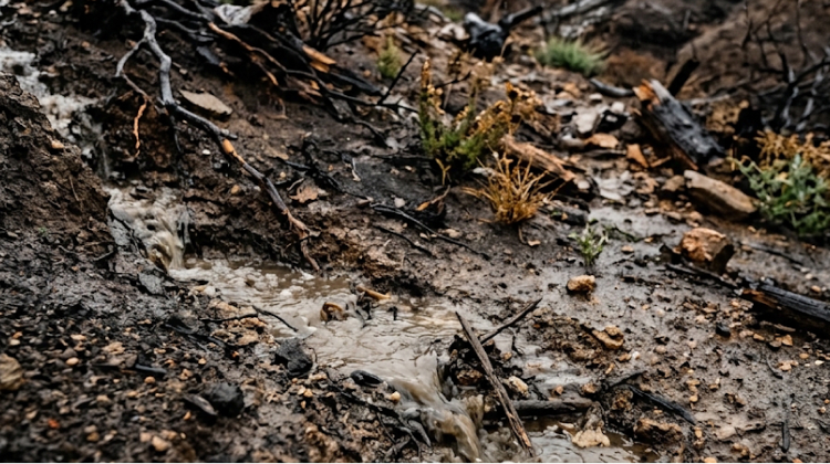
The resulting debris flows can contain mud, branches, boulders, and other material. Unlike ordinary surface runoff, these flows can travel through narrow canyons and drainage channels, threatening roads, buildings, and infrastructure below burned slopes.
The danger depends on several factors, including the severity of the fire, the condition of the soil, slope steepness, and the intensity of rainfall. A storm delivering modest total rainfall can still produce problems if a thunderstorm concentrates heavy rain over a small area in a short period.
The National Weather Service warned on October 20 that localized rain rates could exceed 0.5 inches per hour, creating concerns about minor debris flows near recent burn scars. The agency also identified a lower but nonzero possibility of rain rates exceeding 0.9 inches per hour, particularly in areas under flood watches.
These conditions matter in the Santa Monica Mountains, where steep slopes meet developed neighborhoods, canyon roads, and popular recreation areas. The Palisades and Altadena areas also contain terrain affected by the destructive January 2025 wildfires. Residents near these locations should pay attention to official alerts rather than assuming that a property is safe simply because it sits outside the original fire perimeter.
A debris flow can develop quickly and leave little time for people to react once moving mud and rocks enter a drainage channel. Residents should avoid entering canyons, crossing flooded roads, or approaching channels carrying fast-moving water.
Santa Monica Mountains And Ventura County Face Elevated Concerns
The National Weather Service identified the Santa Monica Mountains as a leading area of concern for flooding during the October storm. Los Angeles and Ventura counties were forecast to experience a 30% to 40% chance of thunderstorms, while the estimated chance was lower, at 15% to 25%, across Orange, Riverside, San Bernardino, and San Diego counties. These percentages describe the forecast probability of thunderstorms, not the probability that every location will flood.
Rainfall estimates varied by location. Forecasts cited by the Los Angeles Times included approximately 1.73 inches for Thousand Oaks, 1.53 inches for Oxnard, 1.47 inches for Santa Clarita, and 1.31 inches near Los Angeles International Airport. Some mountain and foothill locations could receive considerably more precipitation than nearby urban areas.
The National Weather Service also issued flood watches for vulnerable areas, including the Malibu coast and the eastern and western Santa Monica Mountains recreation areas. The watches warned that excessive rainfall could cause flooding in urban areas with poor drainage, as well as along creeks and rivers. Residents were advised to monitor subsequent forecasts and be ready to act if warnings were issued.
For people living near steep slopes or drainage channels, the practical response is to review local emergency alerts, identify safe routes away from vulnerable areas, and avoid waiting for visible flooding before responding to an official evacuation instruction.
Visitors planning hikes or scenic drives should check the status of individual trails, roads, and recreation areas before departing. Heavy rain can cause temporary closures even where no wildfire is active, and conditions can change faster than published travel itineraries.
Coastal Communities Must Prepare For Rain And Dangerous Surf
The storm’s effects are not limited to inland hillsides. The National Weather Service warned of elevated surf, dangerous rip currents, and a moderate risk of minor tidal overflows or coastal flooding in parts of Southern California.
These hazards can coincide with rainfall, making beach visits more dangerous than usual. Waves can surge across low-lying sections of shoreline, while runoff may accumulate in streets and parking areas near the coast. Visitors standing on rocks, jetties, or exposed sections of beach may be caught by unexpected waves.
The warning is relevant to communities from Ventura and Malibu through Long Beach, Orange County, and the San Diego coastline. Local conditions will vary with tide timing, beach orientation, and the direction of incoming swell.
Travelers should follow advice from lifeguards and local officials, stay away from exposed rocks and jetties, and avoid entering the ocean during hazardous conditions. Parents should keep children close to them near the water, and swimmers should use beaches with lifeguards when conditions permit.
California’s coastline has also experienced significant erosion and infrastructure damage during recent high-surf events. Those existing problems can complicate access to beaches, walking paths, and coastal parks when another storm arrives.
Visitors can use the California destinations guide to explore alternative places to visit, but current beach advisories and park notices should take priority over previously planned activities.
Rain Could Disrupt Roads And Outdoor Travel
The first significant storm of the season can create challenging driving conditions after a prolonged dry period. Rain may mix with accumulated dust and debris on road surfaces, reducing traction. Water can collect in low-lying intersections, while runoff from steep terrain can carry gravel and sediment onto highways.
The risks are greater during thunderstorms, when rainfall intensity can increase sharply within a short period. Drivers may encounter standing water, reduced visibility, fallen branches, or temporary road closures as emergency crews respond to incidents.
Motorists should allow additional travel time, increase following distance, use headlights in poor visibility, and avoid driving through water covering a road. Even shallow-looking water can conceal damaged pavement or stronger currents. If a road is barricaded, drivers should use another route rather than attempting to cross.
Outdoor recreation also requires adjustments. Hiking trails can become slippery, creek crossings can rise quickly, and canyon routes may be vulnerable to falling rocks or debris. Campers should check campground notices and avoid setting up near dry creek beds or drainage channels that could carry runoff during a storm.
In the Sierra Nevada, the same weather system brings a different set of hazards. The National Weather Service and regional reporting forecast significant high-elevation snowfall, with some locations near Mammoth potentially receiving up to 10 inches. Tioga Pass in Yosemite National Park was scheduled for a temporary closure ahead of the storm on October 21. Travelers heading into the mountains should check road conditions and park alerts before leaving.
The changing conditions demonstrate why a single statewide weather summary is not enough for trip planning. Rainfall, snow, wind, and coastal hazards can differ sharply between regions, even within the same day.
How Residents Can Prepare Before Heavy Showers Arrive
Preparation is especially important for people living near burn scars, steep hillsides, flood channels, and roads that have flooded in previous storms. Residents should monitor the National Weather Service, county emergency-management agencies, and local fire departments for updates throughout the event.
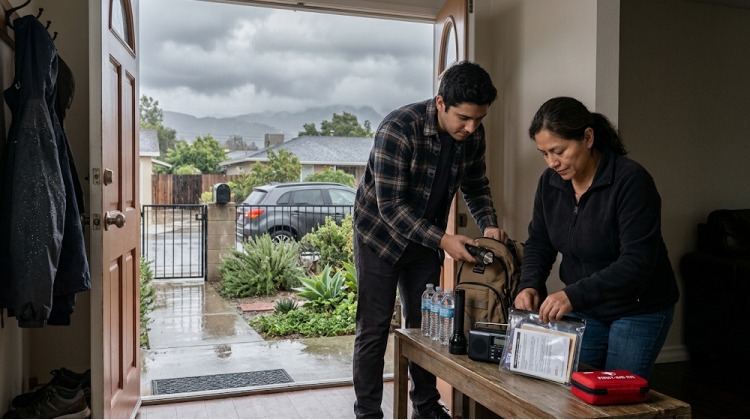
Practical precautions include:
- Clear drainage areas safely. Remove leaves and loose debris from household drains and gutters before the heaviest rain, provided the work can be completed safely.
- Prepare for temporary flooding. Move important belongings away from low floors, keep essential documents protected, and identify a safer place to go if local officials advise leaving.
- Check evacuation information. Enable emergency notifications and learn which routes are available if a road becomes impassable.
- Avoid burned slopes and drainage channels. Stay away from unstable hillsides, ravines, and areas where water could carry mud and rocks downhill.
- Reconsider unnecessary travel. Delay hikes, canyon drives, and beach visits when warnings indicate dangerous conditions.
Residents should never attempt to walk, swim, or drive through floodwater. If local officials issue an evacuation order, follow it promptly rather than waiting to see whether water or debris reaches the property.
People living near recent burn scars should also remember that danger can persist after the rain stops. Saturated soil, weakened trees, and unstable slopes may remain hazardous, while additional showers can reactivate runoff channels.
For more detailed guidance, the National Weather Service provides flood safety information, including advice on flash flooding and avoiding moving water.
What The Storm Could Mean For California’s Winter Season
The October storm arrives as forecasters discuss the potential effects of a strong El Niño on California’s upcoming wet season. El Niño changes ocean and atmospheric conditions across the Pacific, influencing storm tracks and seasonal precipitation patterns. However, it does not guarantee that every region will receive above-average rainfall or that every storm will be severe.
A recent analysis of seasonal projections by the San Francisco Chronicle found that snowfall estimates for the Sierra Nevada vary by location and time of year. Some models suggest lower-than-average snowfall early in the season near Tahoe and Donner Summit, followed by above-average snowfall later in winter. Forecasts for the central Sierra near Yosemite were more favorable for above-average snowfall, although model differences remain significant.
The important distinction is between a seasonal outlook and a short-range weather forecast. The October storm can be assessed using current rainfall estimates, flood watches, and local warnings. Predictions about the full winter season carry greater uncertainty and should not be treated as a guarantee of prolonged flooding or exceptional snowfall.
California’s preparation for a wetter season includes monitoring flood-control infrastructure, preparing emergency supplies, and identifying vulnerable communities. On October 21, The Washington Post reported that state officials were increasing preparations for possible El Niño-driven storms, including the distribution of sandbags and portable flood barriers and inspections of flood-control systems.
For residents and visitors, the immediate priority remains the current storm. Seasonal forecasts can help people plan ahead, but local alerts provide the most useful information for decisions about travel, recreation, and property safety.
California’s First Fall Storm Is A Reminder To Stay Alert
The October 21–22 storm highlights the range of hazards that can accompany California’s transition from dry autumn weather to the rainy season. Burned hillsides face potential debris flows, coastal communities must contend with dangerous surf, and road users may encounter flooding, poor visibility, and changing access conditions.
The greatest concerns are concentrated in areas where intense rain overlaps with steep terrain, recent wildfire damage, or inadequate drainage. Yet conditions can vary significantly across short distances, and forecasts may change as thunderstorms develop.
Residents should keep track of local warnings, prepare for temporary disruptions, and follow evacuation instructions from emergency authorities. Travelers should verify road, trail, beach, and park conditions before setting out, with particular caution around canyons, recently burned landscapes, and exposed coastal areas.
California’s first major fall storm does not determine what the entire winter will bring. It does, however, provide an early test of the state’s ability to manage the transition from wildfire season to periods of heavy rain. Staying informed and responding to local conditions can help residents and visitors reduce risk while the storm moves through the region.