

Southern California is facing a renewed wildfire emergency as powerful Santa Ana winds fuel brush fires, trigger evacuation orders, and force utility companies to cut electricity or prepare preventive shutoffs. On October 15, 2026, the Bryson Fire ignited near Encinal Canyon Road in Malibu and expanded quickly across the dry hills of the Santa Monica Mountains, prompting evacuation orders and warnings for nearby communities.
By Thursday night, the fire had reached approximately 200 acres, according to the Associated Press. Los Angeles County officials also ordered the evacuation of a juvenile detention and rehabilitation facility threatened by the blaze. The cause of the fire remained under investigation, and the rapid growth underscored the danger posed by strong offshore winds.
The emergency extends beyond Malibu. Fires also broke out near Azusa and at Camp Pendleton in San Diego County, while power shutoffs affected customers in several parts of California. The National Weather Service forecast Santa Ana winds with gusts reaching 50 to 70 mph in some mountain areas, alongside low humidity and unusually warm temperatures. Red Flag Warnings were in effect across large parts of Southern California as officials prepared for continued fire danger through the weekend.
For residents, outdoor recreation enthusiasts, and visitors planning trips along the coast, the situation highlights the need to monitor evacuation alerts, verify road and park access, and prepare for possible electricity disruptions.
Bryson Fire Spreads Across The Santa Monica Mountains
The Bryson Fire began on the afternoon of Thursday, October 15, near Encinal Canyon Road in Malibu. According to the CAL FIRE incident page, the Los Angeles County Fire Department had jurisdiction over the incident. Early updates documented growth from 35 acres to 102 acres, followed by a later report of approximately 200 acres that evening.
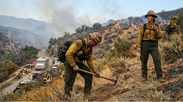
The fire’s rapid expansion occurred during a period of strong offshore winds, which can push flames through dry vegetation and carry embers ahead of the main fire. Steep terrain and narrow roads in the Santa Monica Mountains can complicate firefighting operations and make evacuation decisions especially time-sensitive.
Los Angeles County issued evacuation orders for designated areas near the fire, with evacuation warnings extending to additional zones. The warnings covered a wider area around the Santa Monica Mountains, including locations near Leo Carrillo State Park and the Malibu coast. A warning indicates that residents should prepare to leave if conditions worsen; an order means people in the affected zone must leave immediately.
The fire also threatened the Camp Kilpatrick juvenile detention and rehabilitation facility. The Associated Press reported that the facility was evacuated Thursday night as the flames spread. The incident page listed the cause as under investigation, and the available updates did not confirm structural losses or civilian injuries at the time of reporting.
Residents should not rely on general descriptions of the fire perimeter to determine whether their homes are safe. Evacuation zones can change as wind direction, fire behavior, and emergency assessments evolve. People in the affected area should consult current notices from Los Angeles County and follow instructions from emergency personnel.
The latest official information is available through the CAL FIRE Bryson Fire incident tracker, which includes incident updates and evacuation-zone information.
Santa Ana Winds Increase Fire Danger Across Southern California
Santa Ana winds are dry, warm offshore winds that develop when air flows from inland areas toward the Southern California coast. As the air descends through mountain passes and canyons, it compresses and warms, often reducing humidity. When these winds meet dry brush and grass, a small ignition can develop into a fast-moving fire.
The National Weather Service Los Angeles/Oxnard office warned that moderate to strong Santa Ana winds, low humidity, and hot temperatures would create elevated fire danger. Forecasts called for winds of 20 to 40 mph, with gusts of 50 to 70 mph in some mountain locations. The Red Flag Warning for much of Los Angeles and Ventura counties was scheduled to remain in effect through Saturday evening, October 17.
The agency’s official Los Angeles weather updates also warned of potential downed trees, damaged power lines, and electricity outages. Forecasters advised residents to avoid activities that could create sparks, prepare for possible outages, and maintain an evacuation plan.
Wind strength is only one factor in fire behavior. Low relative humidity can dry vegetation further, while gusts can push flames and embers into new areas. The combination can make it difficult for crews to establish control lines before a fire grows.
The latest event also arrives less than two years after the devastating January 2025 fires in the Los Angeles region. The Palisades and Eaton fires demonstrated how extreme fire weather can threaten densely populated communities. The current Santa Ana event is not a repeat of that disaster, but the history reinforces why officials take red-flag conditions seriously.
Residents should avoid outdoor burning, welding, and other spark-producing work during dangerous fire weather. Drivers should also use caution on exposed roads, particularly in mountain and canyon areas where gusts can affect vehicle handling.
Other Fires Put Communities And Roads On Alert
The Bryson Fire was one of several fires reported across Southern California on October 15. In Azusa, north of Los Angeles, the Peak Fire burned more than 40 acres before firefighters stopped its forward progress later in the afternoon, according to the Associated Press. Evacuation orders for a neighborhood near the San Gabriel Mountains were subsequently downgraded to warnings.
Farther south, the Henderson Fire broke out at Camp Pendleton, the Marine Corps base near San Diego. The fire grew to more than 1,400 acres, threatening buildings and prompting evacuation orders in the Las Flores area. Military officials said those orders were lifted by the evening, while a portion of Interstate 5 was temporarily closed as crews responded.
The incidents illustrate how one wind event can create multiple simultaneous demands on firefighters, law enforcement, utility crews, and emergency managers. Resources may need to be deployed across different jurisdictions while officials track changing wind conditions and possible new ignitions.
Travelers should check road conditions before driving through affected areas. A temporary closure may be lifted once the immediate danger passes, but access can change again if smoke, fire activity, or falling trees create new hazards. Drivers should never bypass barricades or enter an evacuation area to reach a planned destination.
Visitors heading toward Malibu, the Santa Monica Mountains, or coastal recreation areas should verify park status directly with the managing agency. A beach or trail outside the immediate fire perimeter may still close because of evacuation operations, hazardous winds, or limited emergency access.
California Times’ California destinations guide offers ideas for alternative trips, but current fire and weather alerts should take priority over any previously planned itinerary.
Power Shutoffs Affect Customers Across California
The fire emergency has also led utilities to interrupt electricity service or prepare for additional preventive shutoffs. These measures are intended to reduce the chance that electrical equipment will ignite vegetation during severe wind conditions.
The Associated Press reported that approximately 62,000 Pacific Gas and Electric Company customers across 26 counties had lost power by Thursday, while Southern California Edison reported that about 65,000 customers in Los Angeles, Kern, and Ventura counties had lost service. PG&E separately notified roughly 90,000 customers in 29 counties that they could be affected by planned shutoffs.
Southern California Edison was considering additional Public Safety Power Shutoffs that could affect approximately 207,000 customers, according to the same report. These figures describe different groups and stages of the outage response: customers already without power, customers notified of potential shutoffs, and customers within possible additional shutoff areas. They should not be added together as a single count of confirmed outages.
PG&E’s potential shutoff area spans parts of Northern and Central California, including Sierra foothill communities, wine country, and the Central Coast. In the Bay Area, potential impacts included portions of the Berkeley and Oakland hills. These areas face Diablo winds, a dry offshore wind pattern that can create fire danger similar to Santa Ana winds in Southern California.
Residents should consult their own utility’s current outage information rather than assume a regional estimate applies to their address. PG&E customers can use the company’s Public Safety Power Shutoff updates. Southern California Edison customers should check the utility’s outage and safety information.
What Residents Should Do Before Conditions Worsen
A power shutoff can affect more than household lighting. Residents may lose internet access, refrigeration, electrically powered medical equipment, garage-door operation, and other essential services. In some areas, mobile coverage or water systems may also be affected by a prolonged outage.

Californians should prepare for both the possibility of evacuation and the possibility of remaining at home without electricity. Those who receive evacuation orders should leave promptly and follow instructions from local authorities rather than waiting for the fire to become visible.
Useful preparations include:
- Charge essential devices: Keep phones, battery packs, and necessary medical equipment charged. Save emergency contacts and important travel information for offline access.
- Prepare safe lighting: Keep flashlights and spare batteries available. Avoid candles during a high-fire-risk event.
- Secure outdoor objects: Bring in lightweight furniture, decorations, and items that could be blown into roads or power lines.
- Plan for medical needs: Anyone dependent on powered medical equipment should discuss backup arrangements with their healthcare provider and identify a safe alternative location if needed.
- Know evacuation routes: Identify more than one route where possible, keep the vehicle fueled or charged, and prepare essential documents and supplies.
Residents should also avoid using generators indoors or in enclosed spaces. Portable generators must be operated outdoors, well away from doors, windows, and vents, because their exhaust can cause fatal carbon monoxide poisoning.
People living near brush-covered hillsides should keep emergency alerts enabled and understand the difference between an evacuation warning and an evacuation order. A warning offers time to prepare and may be followed by an order; an order means residents should leave immediately.
What The Wind Event Means For Parks And Outdoor Recreation
The Santa Monica Mountains are home to popular trails, scenic overlooks, campgrounds, and coastal parks. During Red Flag Warnings, access restrictions can change quickly as land managers respond to the threat of fire and the need to keep roads available for emergency crews.
California agencies have introduced a coordinated closure protocol for certain Santa Monica Mountains parklands during Red Flag Warnings. State parks included in the initial plan include Malibu Creek State Park, Point Mugu State Park, Topanga State Park, Leo Carrillo State Park, Will Rogers State Historic Park, and Santa Susana Pass State Historic Park. The exact closures depend on the current warning and decisions by the agencies responsible for individual properties.
Travelers should check official park notices before departing, even if a reservation has already been made. Do not assume that a trail is open because it lies outside the visible fire area, and avoid driving into neighborhoods subject to evacuation restrictions.
Wind-related hazards may also persist after fire activity slows. Fallen branches, damaged utility lines, smoke, and emergency vehicles can make access unsafe. Residents should treat downed power lines as energized and report them to the utility or emergency services rather than approaching them.
For tourism businesses, the event can bring last-minute cancellations and service interruptions. Hotels, campgrounds, and activity operators should communicate directly with guests about closures, alternate access routes, and any outage-related changes to operations.
California’s Fire Preparedness Faces Another Test
The fires that erupted on October 15 show how quickly dry, windy weather can turn into a regional emergency. The Bryson Fire’s growth in Malibu, the Peak Fire near Azusa, and the Henderson Fire at Camp Pendleton required responses from multiple agencies while utility companies managed the risk of power-related ignitions.
The immediate priority remains the safety of residents, firefighters, and people traveling through affected areas. Fire acreage and evacuation boundaries can change, while utility decisions depend on weather forecasts and inspections of electrical equipment. Readers should use the latest official updates rather than assume that figures reported earlier in the day remain current.
For California residents, the most effective response is preparation: monitor alerts, follow evacuation orders, plan for power interruptions, and avoid activities that could start a fire. For visitors, flexibility matters just as much. Checking park access, road conditions, and accommodation arrangements before traveling can prevent unnecessary exposure to danger.
Santa Ana winds are a recurring part of California’s autumn weather, but their combination with low humidity and dry vegetation creates a serious risk. As crews continue responding to the Malibu fire and other incidents, residents and travelers should remain alert through the end of the Red Flag Warning period and follow instructions from local emergency authorities.