

California is accelerating preparations to protect Highway 1 and vulnerable coastal communities as the state approaches the 2026–2027 winter storm season. On October 27, 2026, Governor Gavin Newsom signed an executive order at Crystal Cove State Park in Newport Beach, directing state agencies to identify high-risk sections of the Pacific Coast Highway, prioritize preventive work, and improve coordination before potentially damaging El Niño storms arrive.
The announcement follows years of costly emergency repairs along the Big Sur corridor and recent damage to beaches, roads, and coastal infrastructure. According to the Governor’s Office, emergency project expenditures on Big Sur’s Highway 1 corridor totaled approximately $312 million between 2020 and 2026. The new order establishes a Highway 1 Task Force to identify vulnerable locations, recommend priority projects and funding needs, and find ways to complete preventive work more quickly.
For residents, businesses, and visitors, the plan could influence how California maintains one of its most important coastal travel routes. However, the executive order does not mean every threatened section will receive immediate repairs or that winter closures can be eliminated. Its immediate goal is to help agencies prepare for risks before storms cause additional damage.
Why California Is Prioritizing Highway 1 Before Winter
Highway 1 connects coastal communities, beaches, state parks, and tourism destinations along California’s Pacific shoreline. In many areas, it also serves as a critical route for residents, emergency responders, deliveries, and workers.
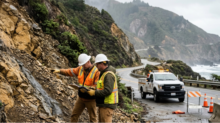
The highway’s location makes it vulnerable to several hazards. Powerful surf can erode beaches and undermine road edges, while prolonged rainfall can saturate hillsides and trigger landslides. Flooding, falling rocks, and debris flows can also force temporary closures, sometimes isolating communities or creating lengthy detours.
The problem is especially visible along the Big Sur coastline in Monterey County, where Highway 1 passes steep slopes and exposed coastal terrain. Repeated storms have required emergency stabilization, roadway repairs, and traffic controls at vulnerable locations.
The October 27 order responds to these risks by shifting more attention toward preventive work. Instead of relying exclusively on emergency repairs after a slide or washout, state agencies are being directed to identify trouble spots and prioritize actions that could reduce damage before the next major storm.
The financial consequences of repeated closures extend beyond road construction. Local businesses depend on visitors reaching restaurants, hotels, shops, and outdoor recreation areas. When a major route closes, travelers may cancel trips, employees can face longer commutes, and emergency services may need alternative access routes.
The state’s announcement frames Highway 1 as both transportation infrastructure and an economic asset whose reliability affects coastal communities.
What Governor Gavin Newsom’s Executive Order Changes
The executive order signed by Governor Gavin Newsom on October 27 creates a formal structure for coordinating Highway 1 storm preparation.
The new task force will be led by the California State Transportation Agency and the California Natural Resources Agency. Its responsibilities include identifying vulnerable stretches of the highway, recommending priority actions, assessing funding requirements, and finding opportunities to speed up preventive work.
The order also directs Caltrans to prioritize landslide prevention where practicable. California State Parks must assess how storm-related closures and repair projects could affect park operations, visitor access, and public safety.
The involvement of multiple agencies matters because coastal hazards rarely stop at the edge of a road. A landslide can affect traffic, nearby homes, park access, drainage systems, and emergency response at the same time. Coordinated planning gives transportation officials, land managers, and emergency agencies a clearer framework for addressing those connected risks.
The order builds on California’s September 21 emergency proclamation related to El Niño and a broader state preparedness initiative announced on October 9. That earlier effort included staging flood-fighting supplies, inspecting water infrastructure, and supporting coastal communities preparing for erosion and flooding.
Readers can review the official announcement and executive-order information through the Governor of California’s October 27 release.
Big Sur’s $312 Million Repair Bill Highlights The Stakes
The approximately $312 million in emergency project expenditures reported for Big Sur’s Highway 1 corridor from 2020 through 2026 illustrates the scale of the challenge.
That figure covers emergency project expenditures over the stated period; it should not be interpreted as the total lifetime cost of maintaining Highway 1 or as the budget allocated to the new task force.
Big Sur is particularly challenging because sections of the road run between steep coastal mountains and the Pacific Ocean. When slopes fail or ocean-driven erosion damages the roadway, crews may have limited space to conduct repairs without affecting traffic.
The Mud Creek area south of Big Sur has been a major example of the corridor’s vulnerability. Caltrans’ current highway information lists emergency work there, with one-way controlled traffic scheduled on weekdays through November 13, 2026. The same update lists additional controlled-traffic sections near Point Sur and Rocky Creek Bridge.
These restrictions show that highway maintenance remains an ongoing process, even outside a major storm emergency.
Preventive work can include slope inspections, drainage improvements, stabilization measures, and preparation of equipment and materials before hazardous weather arrives. The task force is expected to help determine where these measures should receive priority, although the final locations, schedules, and funding decisions will depend on agency assessments.
For drivers, the practical takeaway is that Highway 1 conditions can change from one section to another. A route may remain open overall while particular stretches operate under one-way traffic controls or experience delays.
Caltrans Is Preparing Equipment And Crews Across California
Highway 1 is the main focus of the October 27 order, but Caltrans is also preparing its statewide operations for winter weather.
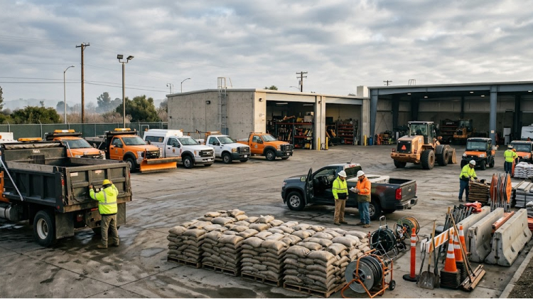
According to the Governor’s Office, the department is positioning storm-response supplies at more than 120 maintenance yards and has approximately 1,300 pieces of winter operations equipment available for deployment. Crews across all 12 Caltrans districts are preparing to move to continuous storm coverage and 12-hour emergency shifts when conditions require it.
Preparation work includes clearing catch basins, ditches, and culverts; checking pumps and backup generators; and positioning sandbags and sediment-control materials near vulnerable locations. Agencies are also checking equipment needed for snow removal and avalanche control.
These measures support rapid response when conditions deteriorate. Clear drainage systems can help reduce roadway flooding, while equipment positioned near high-risk corridors can shorten response times after a slide or washout.
The preparations do not guarantee that every road will remain open. Some hazards develop quickly, and severe erosion or landslides can require closures even when crews and materials are ready.
The state’s Caltrans road information service provides current highway conditions, while Caltrans QuickMap offers a real-time view of closures, traffic conditions, and other travel information.
Coastal Erosion Is Also Threatening Beaches And Public Access
The executive order was signed at Crystal Cove State Park in Newport Beach, where coastal erosion and a major bluff crack elsewhere in the park highlight the risks facing California’s shoreline.
These problems are not limited to Big Sur. Along the Southern California coast, high tides and powerful surf can strip away sand, expose infrastructure, and increase pressure on roads and coastal bluffs.
The state’s October 9 preparedness announcement identified several ongoing projects. At Carlsbad State Beach, California State Parks has been working with coastal engineers and the California Coastal Commission to protect the shoreline and repair damage to the Tamarack parking lot. The damage followed summer swells and high tides that removed beach sand.
In Malibu, State Parks awarded an emergency contract worth $2.125 million to repair damaged pilings and strengthen Malibu Pier. The work is intended to improve the structure’s condition ahead of winter storm season.
Farther north, the State Coastal Conservancy has invested $16.2 million in the second phase of Ventura’s Surfers Point project, which moves vulnerable infrastructure inland and restores beach and dune habitat.
These projects differ in scope, but they share a central challenge: keeping public infrastructure functional while responding to a coastline that changes under the influence of waves, tides, erosion, and rainfall.
For visitors, this means beach access, parking, trails, and waterfront facilities may be affected even when the main highway remains open. Before visiting coastal parks, check the relevant park’s official notices and operating information.
What El Niño Means For Highway 1
El Niño is a climate pattern associated with warmer-than-average sea surface temperatures in the central and eastern tropical Pacific. It influences atmospheric circulation and can change rainfall and storm patterns across different regions.
In California, El Niño conditions are often associated with an increased chance of wet winter weather. However, El Niño does not guarantee a rainy winter or determine exactly where and when storms will occur. Local impacts depend on the storm track, atmospheric conditions, soil moisture, coastal water levels, and other factors.
For Highway 1, the main concerns include heavy rainfall, landslides, debris flows, flooding, and coastal erosion. Saturated hillsides can become unstable, while strong surf can damage shoreline infrastructure even when rainfall is limited.
The California Coastal Commission’s El Niño preparedness guidance provides additional information about coastal flooding, erosion, and steps property owners can take to prepare.
The state’s planning also accounts for longer-term climate risks. Rising sea levels and changing coastal conditions can increase the pressure on roads built close to beaches, bluffs, and ocean-facing slopes. Preventive maintenance may reduce near-term damage, but some locations will require longer-term engineering decisions and investment.
What Highway 1 Travelers Should Do Before A Coastal Trip
The new task force is intended to improve preparedness, but travelers should continue checking road conditions before departure. Planned maintenance, emergency work, and storm-related closures can affect different stretches of Highway 1 independently.
Before setting out, drivers should:
- Check current road conditions. Use Caltrans QuickMap and the official highway information service to identify closures, controlled traffic, and delays.
- Allow additional travel time. One-way traffic controls and emergency repairs can create queues, especially on narrow coastal sections.
- Check weather alerts. Rainfall forecasts and warnings can change quickly as a storm approaches.
- Avoid flooded roads. Water can conceal debris, damaged pavement, or a washed-out roadway. Never drive around barricades or through water of unknown depth.
- Keep alternative routes in mind. If a closure occurs, follow official detours and allow extra time for reaching hotels, parks, or other destinations.
Drivers should also inspect tires, windshield wipers, lights, and other basic vehicle equipment before winter travel. In mountain areas, changing weather can introduce additional hazards that are not present along lower coastal sections.
People planning scenic drives should verify access to specific attractions rather than assuming that the entire coast is operating normally. The California destinations guide can help with broader trip planning, but current road and park notices should guide the final itinerary.
How Coastal Communities Could Benefit From Earlier Preparation
The Highway 1 Task Force could help state agencies make decisions about which vulnerable areas require attention first and which preventive projects offer the greatest practical benefit.
For local communities, more coordinated planning could improve communication between transportation officials, park managers, emergency responders, and businesses that depend on road access. Earlier preparation may also reduce the disruption caused when crews must mobilize only after damage occurs.
The benefits will depend on how quickly agencies identify priority locations, secure funding, and carry out the recommended work. The executive order establishes a coordination framework; it does not itself complete repairs or guarantee that storm-related closures will be avoided.
The state will also need to balance immediate safety measures with longer-term coastal planning. Some roads can be reinforced or protected through engineering work, while other locations may require repeated maintenance, changes in access, or more extensive adaptation as conditions evolve.
For Highway 1, that balance is particularly important because the road serves both everyday transportation needs and some of California’s best-known coastal destinations.
California Begins Winter With A Focus On Prevention
California’s October 27 executive order puts Highway 1 at the center of a broader effort to prepare coastal infrastructure for the 2026–2027 winter season. The new task force will identify vulnerable sections, recommend priority projects, and coordinate preventive work across transportation and natural-resource agencies.
The financial history of the Big Sur corridor, including approximately $312 million in emergency project expenditures from 2020 through 2026, demonstrates why the state is looking for ways to reduce repeated damage and costly repairs.
Caltrans is already preparing equipment, checking drainage systems, and staging supplies across its statewide network. Coastal projects in Newport Beach, Carlsbad, Malibu, and Ventura show that the challenge extends beyond a single highway segment.
For travelers, the immediate priority remains checking current road conditions and following official instructions before heading out. For coastal communities, the next step will be turning the new planning framework into targeted projects that improve safety and keep essential routes accessible when conditions allow.
The winter season will test how well these preparations work. The executive order is an important step toward coordinated action, but the actual outcome will depend on storm conditions, project priorities, and how quickly vulnerable locations can be protected.