

Rocky Mountain roads can change quickly in mid-October, especially above tree line. As of October 18, 2026, travelers should plan around seasonal closures, snow and ice at higher elevations, the final Bear Lake timed-entry date, and storm-related road changes before committing to a route.
I treat Rocky Mountain National Park fall drives differently from summer drives. The scenery can still be excellent, but the margin for casual planning is smaller. A dry road near Estes Park does not mean an alpine road is clear, and a sunny morning can still begin with ice in shaded or higher-elevation areas.
The practical plan is simple: confirm the road you want, confirm whether the trailhead road is still open to private vehicles, then check the weather and the park’s recorded road line at 970-586-1222 before leaving. Families should also build in a backup stop at a lower elevation, since seasonal closures can change the shape of a day fast.
Rocky Mountain Roads: What Changed In October
Rocky Mountain Roads At Higher Elevation
The biggest October change involved the high country. Trail Ridge Road was temporarily closed on October 13, 2026, because of snow, ice, and poor visibility between Rainbow Curve on the east side and Milner Pass on the west side. By the October 16 alert cited in the research notes, the closure had shifted to seasonal status between Many Parks Curve and the Colorado River Trailhead, with lower ends possibly accessible from either side depending on weather.
That distinction matters for trip planning. A seasonal closure is not the same as a short delay that clears by midday. If your goal was to drive across the park, connect Estes Park and Grand Lake by Trail Ridge Road, or reach an alpine viewpoint, you should not build the day around full through-access unless the park confirms it. Lower overlooks may still be possible, but the exact limit can change with snow, ice, wind, and visibility.
Old Fall River Road And Seasonal Closures
Old Fall River Road also moved into its closed-for-the-season pattern. The research notes report that October 6, 2026, was the last full day for vehicle access on this 9.4-mile unpaved, one-way road from Endovalley Picnic Area to the Alpine Visitor Center at Fall River Pass. For drivers, that removes a classic scenic route option and puts more pressure on lower-elevation alternatives.
Several smaller park roads follow a seasonal rhythm around mid-October through Memorial Day weekend, with exact dates depending on conditions. The research notes identify Wild Basin Road from the winter parking area to the Wild Basin Ranger Station, Fern Lake Road from the shuttle parking lot to the Fern Lake Trailhead, and Upper Beaver Meadows Road as seasonal-closure candidates during that period. If one of those roads is tied to your hike, picnic plan, or family photo stop, confirm access first rather than assuming a map route is drivable.
Trail, Ice, And Family Safety Checks
Match The Drive To The Trail Conditions
Road access is only part of the safety picture. The National Park Service trail report updated October 9, 2026, said most trails were clear and dry, with some lower-elevation mud from recent rain and possible early-morning ice in high-elevation areas on the NPS trail conditions page. That mix is typical of shoulder-season travel: you can start on dry ground and still meet ice where shade, elevation, and cold overnight temperatures line up.
Reports from October 3 through October 9 also noted snow and ice patches in higher-elevation terrain on Longs Peak, including areas described in the research notes as The Ledges, Narrows, and Homestretch. Those names matter because they point to terrain where a casual hiking mindset is not enough. If your group includes children, first-time visitors, or anyone without winter traction and cold-weather layers, choose lower trails unless the park’s latest update supports a higher route.
What I Would Pack For An October Drive
For an October park drive, I would pack as if the car might sit in cold wind for longer than planned. That means warm layers for every passenger, water, snacks, a charged phone, paper or saved maps, and footwear that can handle mud or icy patches at overlooks. Families should keep gloves and hats within reach, not buried under luggage. If a viewpoint is windy or icy, it is much easier to enjoy five careful minutes outside than to manage cold kids in light sweatshirts.
- Call the recorded road status line at 970-586-1222 before leaving lodging.
- Check whether your chosen road is fully open, partly open, or seasonally closed.
- Plan one lower-elevation backup stop in case high roads close.
- Carry traction-aware footwear for icy parking areas and short walks.
- Give yourself daylight for the return drive, especially after weather changes.
For comprehensive insights on Colorado road trips, I recommend visiting the related Mile High drives site which offers valuable advice on mountain travel as a comprehensive driving experience rather than just a point-to-point route.
Bear Lake Road And Entry Timing
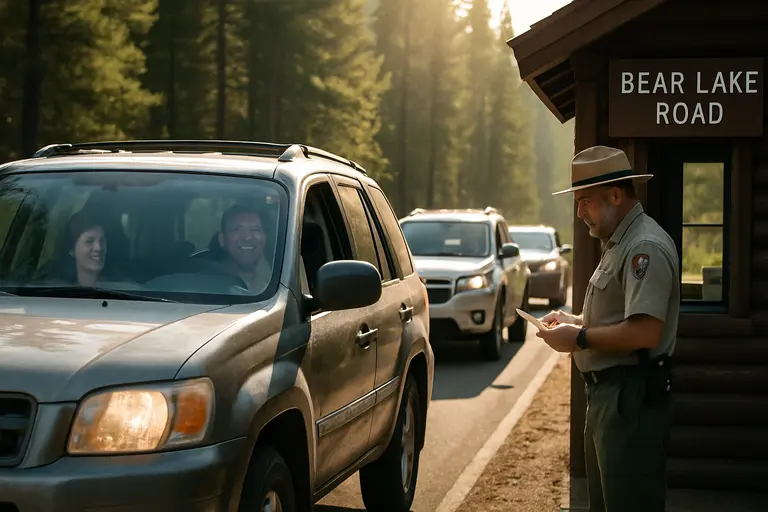
Bear Lake Access On October 18, 2026
Bear Lake Road is the main exception visitors often ask about after other high routes close. The research notes state that Bear Lake Road remains open to vehicles year-round, though it can close temporarily during winter storms; the park’s day-use access planning materials also describe Bear Lake Road as a key year-round access corridor in the visitor access plan. In practice, that means Bear Lake can remain a strong backup for many visitors, but not a no-check-needed option.
Permit timing also mattered in October 2026. Standard timed-entry permits were required through October 12, 2026, while the Bear Lake Road corridor permit requirement was scheduled through October 18, 2026. Because today is October 18, 2026, visitors using that corridor should treat it as the final scheduled permit date in the research notes and verify the day’s access details before driving to the entrance.
Why A Backup Plan Helps
Rocky Mountain roads can funnel visitors toward fewer open routes once alpine roads close. That can make timing, parking, and patience more important, even when a road is legally open. If Bear Lake Road is your plan, start by checking storm conditions and road status. If the corridor has a temporary weather closure, pivot to a lower area rather than waiting without good information.
For readers tracking local access changes beyond this article, our related piece on Rocky Mountain access after road closures pairs well with this safety check. I would use it as a planning companion, then confirm the latest official road status on the day of travel.
Rocky Mountain Roads Drive Check Before You Go
Use A Three-Step Decision
Before driving into the park, make three decisions in order. First, decide whether your goal depends on a high road such as Trail Ridge Road or Old Fall River Road. If it does, check whether that road is seasonally closed or only partly accessible. Second, decide whether your trailhead road has a mid-October seasonal closure, especially for Wild Basin, Fern Lake, or Upper Beaver Meadows. Third, decide whether Bear Lake Road is a practical backup for your group that day.
This is not about avoiding Rocky Mountain roads in fall. It is about matching the day to what the park is actually offering on October 18, 2026. A family with young kids may have a better day choosing a shorter lower-elevation walk, a scenic pullout, and a warm meal after the drive. A more experienced group may still find worthwhile hiking, but only after checking for ice, mud, and changing weather.
What To Verify Before Booking Or Leaving Lodging
If you have not booked lodging yet, avoid choosing a stay based only on a summer route across the park. Trail Ridge Road’s seasonal closure can change drive times between east-side and west-side communities. If you have already booked, ask your lodging host what road status they are seeing locally, then verify with the park before relying on that advice.
The safest planning habit is to treat every October park drive as conditional. Check the recorded road line, read the latest park alerts, confirm permit timing if your date touches the Bear Lake corridor rules, and keep one lower-elevation plan ready. With that approach, Rocky Mountain roads can still make for a rewarding fall visit, even when the highest pavement has moved into winter mode.