Capitol Reef Scenic Drive visitors should plan around two daytime vehicle closures in September 2026. The dates are Saturday, September 19, 2026, and Saturday, September 26, 2026. While some trip notices may describe the restriction as affecting Sundays, the National Park Service announcement identifies both dates as Saturdays, with the closure lasting from sunrise until 3:00 p.m. NPS Reef Ride notice.
The event is called Reef Ride Bike Days. During the closure window, motorized public vehicles will not be allowed on the affected section beyond Fruita Campground. The road space is set aside for cyclists, including Class 1, 2, and 3 e-bikes, along with hikers and runners. State Route 24, Fruita, the campground, and the Gifford House remain accessible by vehicle, so this is not a full park closure. It is a targeted access change on a popular scenic road.
What Changes On Capitol Reef Scenic Drive Bike Days
The main change is simple: if you arrive before 3:00 p.m. on either date and want to drive the paved scenic route beyond Fruita Campground, you will need to wait. If you plan to bike, walk, or run the closed-to-cars section, those activities are allowed during the restricted period. That creates a quieter road experience for people moving under their own power, but it also changes the timing for visitors who built their day around a vehicle-based drive.
Capitol Reef Scenic Drive Access By Time
From sunrise to 3:00 p.m. on September 19 and September 26, 2026, motorized public vehicles are restricted beyond Fruita Campground. After 3:00 p.m., visitors should expect the road to return to normal vehicle access unless conditions or park operations require another change. Because access details can shift due to weather, road work, or park needs, it is worth checking the park page again close to departure rather than relying on an older saved plan.
The Capitol Reef Scenic Drive restriction does not stop visitors from reaching nearby open areas by car. State Route 24 remains available for through travel, and Fruita, the campground, and the Gifford House remain vehicle-accessible. That matters for travelers who are passing through the park as part of a longer Utah road trip and do not have flexibility to wait until midafternoon.
Who The Restriction Works Best For
These two mornings are best suited to visitors who are comfortable biking, walking, or running in a desert park setting. The route is paved, but it is not flat from end to end. Riders should expect a road that gains elevation and offers limited services. This is a good case for being honest about pace, distance, heat tolerance, and whether your bike is suited to paved road riding and possible dirt spur roads.
Route Distance, Elevation, And Bike Fit
The paved Scenic Drive is 7.9 miles, or 12.7 kilometers, one way. It is an out-and-back route, so a rider who continues to the end of the paved segment and returns to the start should plan for about 15.8 miles total. The park notes that the road starts near 5,418 feet, or 1,651 meters, and climbs to nearly 5,977 feet, or 1,822 meters, near the end of the pavement NPS Bike Days details.
That elevation range is not extreme by western mountain standards, but it can still affect visitors who arrive from lower elevations, ride in full sun, or are not used to sustained out-and-back cycling. The return may feel different from the outbound leg depending on wind, temperature, and your own energy level. Since no cell phone reception is available along the Scenic Drive, planning should be more conservative than it might be on an urban bike path.
Speed Limits And Riding Conditions
Bike speed limits are part of the event rules. The limit is 15 mph between the Blacksmith Shop and just past Loop C of the campground. For the rest of the designated route, the limit is 25 mph. These limits matter because the route is shared by cyclists, walkers, runners, park staff, and other authorized users. Faster riders should not treat the road closure as a race setting.
Dirt spur roads to Grand Wash, Capitol Gorge, and Pleasant Creek are accessible during the event period, but they may not suit every bike. A road bike that feels fine on pavement may be less comfortable or less appropriate on dirt. If you plan to include a spur, check your tires, carry repair basics, and be ready to turn around if the surface does not match your equipment or comfort level.
Planning Around Vehicle Access
If your main goal is to drive the route in a car, van, or RV, the cleanest plan is to schedule that portion after 3:00 p.m. on either event date or choose a different day. If your schedule is fixed and you arrive in the morning, use the open vehicle-accessible areas first, then decide whether to wait for the road to reopen. This is especially useful for travelers with children, mobility needs, or a packed road-trip schedule.
For travelers comparing seasonal road rules across the Southwest, the planning habit is similar: verify the date, the allowed vehicle type, and any day-use limits before committing your route. A related road-access planning example is this Cape Royal Road fall travel note, which shows why official timing checks are worth doing before long drives.
What To Do Before Leaving Lodging
Start with the basics: confirm the date, confirm whether your plan depends on driving beyond Fruita Campground, and decide whether your group is prepared to bike or walk instead. If you plan to ride, bring enough water for the full outing, sun protection, snacks, and a repair kit suited to your bike. The route has restrooms at the Picnic Area, at the end of Grand Wash Road, at the end of the paved Scenic Drive, and at the end of Capitol Gorge Road, but restroom access should not be treated as a substitute for carrying your own supplies.
- Driving before 3:00 p.m.: Plan to stay outside the restricted section beyond Fruita Campground.
- Biking the full paved route: Expect about 15.8 miles round trip if you ride to the end and back.
- Using an e-bike: Class 1, 2, and 3 e-bikes are allowed during the event window.
- Relying on phone service: Do not count on cell reception along the route.
- Needing help: Park staff are expected to be stationed along the route for emergency assistance.
Visitors on longer road trips may also want to check vehicle readiness before reaching south-central Utah. For those seeking comprehensive road-focused planning resources, Drive Sat Mile High offers insights into broader travel network planning that complement park access considerations effectively.
Riding The Capitol Reef Scenic Drive Without Cars
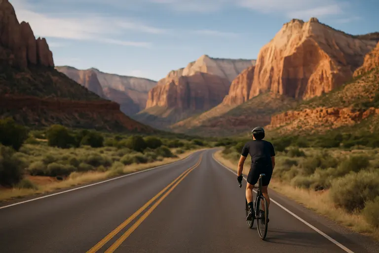
For cyclists, Reef Ride Bike Days offer a rare chance to experience the paved route without ordinary public vehicle traffic during the morning and early afternoon. That does not mean the road is empty or risk-free. Hikers and runners may be present, riders will travel in both directions, and authorized vehicles or staff activity may still appear. Keep right, pass with care, and respect the speed limits.
The best practical approach is to think of the event as a shared-use morning, not a private ride. Start early if you want cooler conditions and more time before the 3:00 p.m. transition. Turn around sooner if water, heat, fatigue, or bike issues become a concern. Since the route is out-and-back, every mile away from Fruita is a mile you need to cover again.
How Non-Riders Can Still Use The Morning
Non-riders are not shut out of the park. They can still access State Route 24, Fruita, the campground, and the Gifford House by vehicle. If your group includes both riders and non-riders, set a clear meeting place in an area open to vehicles. Do not rely on phone calls to reconnect from the Scenic Drive, because the park reports no cell reception along the route.
Visitors who are not comfortable biking the route can also wait until after 3:00 p.m. to drive the restricted section, as long as park conditions allow regular access at that time. For sunset-oriented travelers, that may be a workable plan, but avoid building a tight schedule around a last-minute drive if you still need to reach lodging, dinner, or another destination after leaving the park.
Capitol Reef Scenic Drive Planning Notes
The key planning point is the date correction: the September 2026 vehicle restrictions are listed by the National Park Service for Saturday, September 19, and Saturday, September 26, not Sundays. From sunrise until 3:00 p.m. on those two dates, the affected section beyond Fruita Campground is reserved for cyclists, e-bike riders, hikers, and runners.
For a smoother visit, match your plan to your travel style. Drivers should go after 3:00 p.m. or choose another day. Cyclists should prepare for a paved out-and-back ride of up to about 15.8 miles, elevation gain, enforced speed limits, no cell service, and limited facilities. Mixed groups should agree on a meeting point before separating. With a little advance planning, the Capitol Reef Scenic Drive access change can be manageable whether you are riding the road or adjusting a driving plan.