

Yosemite traffic tools have become a practical part of planning a drive into Yosemite National Park, especially for families trying to avoid long idle time at entrance stations. As of November 6, 2026, the park uses official traffic monitoring, text alerts, and third-party wait-time displays to help visitors make better timing decisions before they reach a gate. These tools do not remove congestion, but they can help you choose a route, prepare the car, and decide whether to slow down, stop outside the park, or adjust expectations before entering.
Yosemite traffic tools For Gate Planning
The most useful shift for road-trippers is that gate wait information is no longer limited to word-of-mouth or a guess based on the season. Yosemite National Park operates seven license-plate reader cameras, and four of them are used to measure entrance wait times at Arch Rock, South Entrance, Big Oak Flat, and the park boundary at Highway 140. The National Park Service says the system measures travel times and gate wait times by matching plates seen at two points, with plate data anonymized and not linked to law enforcement or DMV databases through the park system Yosemite LPR details.
That matters if you are traveling with kids, older relatives, or anyone who struggles with long stretches in a stopped car. A 20-minute delay and a two-hour delay call for different decisions: restroom timing, fuel stops, snacks, motion-sickness planning, and whether to wait outside the park until the line eases. I would not treat any live wait time as a promise, since traffic can change quickly after a crash, full parking area, weather shift, or sudden arrival wave. Still, a recent measurement is far better than entering the Sierra foothills with no sense of what the gates look like.
Yosemite traffic tools At The Entrances
The official camera system is focused on measured vehicle movement, while a third-party service, Yosemite.live, displays live entrance wait times that are reported as updated every five minutes for four driving entrances: Arch Rock, Big Oak Flat, South Entrance, and Tioga Pass. The same service also shows gate-hours information for Hetch Hetchy. Because Yosemite.live is not the National Park Service, I would use it as a planning aid rather than the only source for a final decision.
For families, the best use is comparison. If one entrance shows a much longer wait than another and your route can reasonably change before you commit to mountain roads, that information may help. If you are already close to a gate, it may be more useful for setting expectations than changing course. In mountain driving, a different entrance can mean a long detour, fuel concerns, or a tougher drive after dark, so the shorter line is not automatically the better choice.
What The Plate Readers Do And Do Not Mean
The license-plate reader system can sound intrusive at first, so it is worth reading the park’s explanation before you go. According to the National Park Service, the cameras are used for traffic and visitor-use monitoring. Plate images are retained for 30 days, while anonymized textual records such as timestamps and vehicle counts are retained as part of visitation history and park management data. The stated purpose is measuring travel time, gate wait time, and traffic patterns, not identifying visitors for ordinary travel through the park.
For trip planning, that means the system is mainly a measurement tool. It does not reserve your place in line, replace a ranger’s direction, or guarantee that parking will be available once you are inside Yosemite Valley. If the park is busy enough that lots fill, the entrance wait is only the first stage of the drive.
Text Alerts, Apps, And Road Information
Text alerts are still one of the simplest ways to receive traffic updates without repeatedly refreshing a web page. Visitors can register for Yosemite traffic updates by texting YNPTRAFFIC to 333111. The 511 traveler information service lists this Yosemite traffic alert option for current traffic conditions, gate delays, and parking status 511 traveler services.
That is especially useful if one adult is driving and another can monitor messages. If you are traveling solo, set up the alert before leaving town, then check only when parked. Mountain roads into Yosemite demand attention, and no wait-time update is worth distracted driving.
Yosemite.live also offers crowd-prediction features based on measured traffic-pattern history, including hourly entrance forecasts, full-week outlooks, and Google Maps traffic overlays for approach roads. These features are useful before departure, not just at the park boundary. If a forecast points to a heavy arrival period, you can plan breakfast, fuel, and restroom stops before joining the approach traffic.
Phone Setup Before You Lose Time
The most useful gear is basic: a charged phone, a charging cable that works with your vehicle, and a way for a passenger to check alerts without passing a phone around the car. If you use an app for wait times, open it before you reach the final approach road so you know it loads and displays the entrance you plan to use. If you rely on text alerts, sign up before the day becomes busy, not while sitting at the gate.
I also like having a written backup with the entrance names, the route number, and the order of decision points. For example, if you are choosing between Big Oak Flat and Arch Rock, decide where that choice actually happens on your route. Once you pass that point, a wait-time change may no longer be helpful. This is where Yosemite traffic tools are best treated as decision support, not a command to keep switching roads.
What To Check Before Booking Or Driving
Yosemite dropped its 2026 peak-hour reservation requirement, according to the research provided for this article, and part of the visitor-management shift has been greater use of real-time information. That makes pre-trip checking more important, not less. Without a peak-hour reservation screen shaping arrivals, many visitors may still choose the same morning windows, especially during spring through fall, weekends, and holidays.
The park’s traffic information has warned that entrance-station delays can be common during busy periods. Research notes also show that Yosemite previously piloted near-real-time messaging for parking and gate waits in 2023; the pilot increased visitor awareness but did not reduce the total number of vehicles arriving during peak periods. In practical terms, information helps you plan, but it does not make the road empty.
How Families Can Use Gate Wait Updates
For parents, grandparents, and mixed-age groups, gate wait updates are most helpful when they trigger small choices early. I would use them before leaving lodging, before the last major town stop, and again before committing to the final approach. That rhythm keeps the day flexible without turning the whole drive into phone checking.
- Before departure: check the entrance you plan to use and compare it with any realistic alternate route.
- At the last services stop: handle fuel, restrooms, water, and snacks if the wait looks long.
- Before the final approach: decide whether to continue, pause nearby, or accept the delay.
- Inside the park: remember that full parking areas can still create slow traffic after the gate.
For broader regional travel ideas before or after a Yosemite road trip, I also keep an eye on related travel sites such as Baja Times, which is part of the same travel network and useful for West Coast trip planning beyond the Sierra.
One caution: do not build a tight day around the shortest displayed wait. If you have a timed hotel check-in, dinner plan, or a child who needs a predictable nap, leave space in the schedule. Yosemite traffic tools are helpful, but they cannot control parking demand, weather, construction effects, or ranger-directed traffic changes.
Limits Of Real-Time Yosemite Gate Data
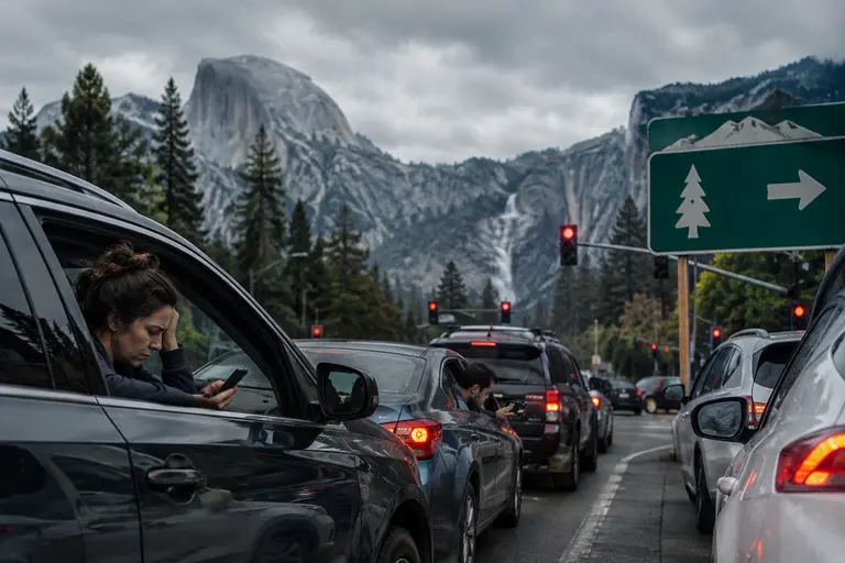
Real-time gate data can make a Yosemite trip feel more manageable, but it should not be confused with certainty. The official plate-reader system measures vehicle movement at certain points. Third-party tools may display frequent updates and forecasts. Text alerts may warn you about delays and parking status. Each tool answers part of the same question: what is happening now, and what might happen soon if patterns hold?
The limits matter most during the busiest visitor periods. A gate line can grow after a wave of arrivals, and a relatively smooth entrance can still lead to slow traffic in Yosemite Valley if parking fills. Hetch Hetchy is also a different planning case because gate hours and parking pressure may shape the experience differently from the main Yosemite Valley approaches.
My practical advice is to use Yosemite traffic tools in layers. Start with the official park traffic and alert systems, then compare third-party wait displays if they are available. Prepare your vehicle as if the line will be longer than you hope: full enough fuel, water within reach, snacks for kids, and a charging setup that does not depend on a single low battery. If the wait is short, you lose nothing. If it stretches, the car is ready.
Yosemite Gate Wait Planning In 2026
As of November 6, 2026, the smarter Yosemite road trip is not about chasing a perfect arrival time. It is about checking the right information early enough to act on it. Use the official traffic alert text system, understand what the license-plate reader system measures, and treat app-based wait times as helpful but imperfect. For a family drive, that approach can reduce stress even when it cannot remove traffic.
The real value of Yosemite traffic tools is not just saving minutes at a gate. It is knowing when to stop before the park, when to reset expectations, and when to keep the route simple. On a mountain trip, calm decisions are part of the gear.